Municipal Corporation Jaipur Greater Ward No. 66 in Sanganer Legislative Assembly Constituency
नोटिस क्रमांक एफ 4 () अति.अ./सा.प्र./ननिज/वार्ड पुर्नगठन/2019/54 दिनांक 8 दिसम्बर 2019 के अनुसार वार्ड 66 परिसीमन and 5th Jan 2020 LOCAL SELF GOVERNMENT DEPARTMENT F.10 (Elec) LSG/20/2 Gazette Notification of Ward Delimitation Nagar Nigam Jaipur Greater
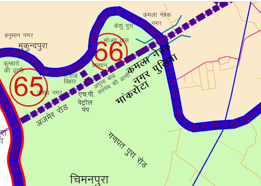
अजमेर रोड पुलिया के नीचे से पश्चिम की तरफ अजमेर रोड पर चलते हुये हिन्दुस्तान पेट्रोल पम्प तक दाहिनि क्षेत्र को लेते हुये अगुना बाढ संरपच की ढाणी सम्मलित करते हुए नारायण विहार-जेड तक। यहां से हिन्दुस्तान पेट्रोल पम्प से नटराज विहार विधानसभा सीमा तक उत्तर की तरफ दाहिनि भाग को लेते हुये एवं यहां से नटराज विहार से पूर्व की तरफ विधानसभा सीमा के सहारे सहारे कमला नेहरू नगर, उषा कालोनी व कैसरी चन्द चौधरी जैन कालोनी को छोडते हुये दाहिनि भाग को सम्मिलित करते हुये अजमेर रोड पुलिया के नीचे तक का समस्त भाग
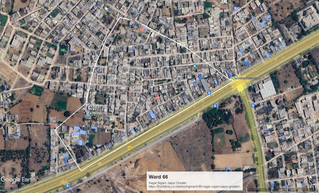
JMC Greater Ward 66
Population : 10312
Area : 14.5 hectares
Density : 736.57 PPH
Moving from under the Ajmer Road bridge towards the west on Ajmer Road, including the area to the right up to Hindustan Petrol Pump, encompassing Aguna Baad Samrapach Ki Dhani while moving towards the west, up to Narayan Vihar-Zed. From here, taking the right side towards the north, including the area to the right, from Hindustan Petrol Pump to Natraj Vihar Assembly boundary, and from Natraj Vihar towards the east to the Assembly boundary, including Kamla Nehru Nagar, Usha Colony, and Kaisari Chand Choudhary Jain Colony, while excluding the right side, encompassing the entire area up to under the Ajmer Road bridge.
Download Map
NNJ Greater : Demarcation of Ward in Nagar Nigam Jaipur Greater Map .pdf
NNJ Heritage : Demarcation of Ward in Nagar Nigam Jaipur Heritage Map.pdf
Home page : Demarcation of Ward in Nagar Nigam Jaipur
1 Comment
[…] No. 65 | Ward No. 66 | Ward No. 67 | Ward No. 68 | Ward No. 69 | Ward No. 70 | Ward No. 71 | Ward No. 72 | Ward No. 73 | […]